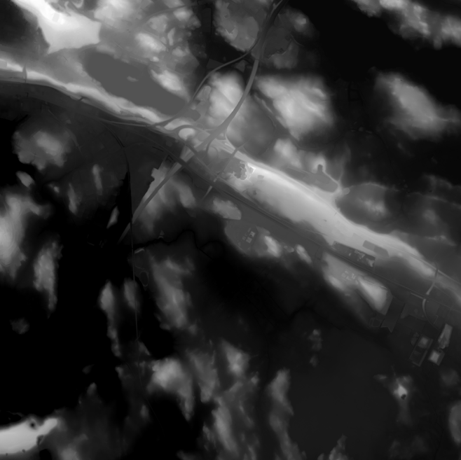
Elevation model 2 m
Elevation model 2 m is a model depicting the elevation of the ground surface in relation to sea level. Its grid size is 2 m x 2 m. The dataset is based on laser scanning data, the point density of which is at least 0.5 points per square metre. The product's coverage is based on nationwide laser scanning. In some parts of the outer archipelago or the eastern border, the elevation model is not available.
Elevation model 2 m is produced in two quality classes: the elevation accuracy in class I is on average 0.3 metres and the elevation accuracy in class II varies between 0.3 metres and one metre.
The product belongs to the open data of the National Land Survey of Finland.
Purpose:
The elevation model allows for example simulation of areas with a high risk of flooding or that of receiving, coverage and service areas. The model can also be used for mass calculation of excavated material and land-fill and for calculating inclinations, steepness or profiles. Application areas are found, for example in geol-ogy, geography and forestry.
Geographic location
Entire Finland
Reference system
ETRS89 / TM35FIN(E,N) (EPSG:3067)
N2000 height (EPSG:3900)
Pixel size
2 m
Spatial representation
Raster
Data content
Elevation model 2 m depicts the height of the terrain above sea level. The height values are in accordance with the system N2000.
Elevation model 2 m is the most accurate elevation model of Finland which covers extensive areas. Approximately 40,000 square kilometres are added into the model every year.
Maintenance
Maintenance
The product is updated as necessary. The elevation model is updated according to the laser scanning of the previous season if significant changes have been detected on the Earth's surface.
Map of the current status: https://tilannekartta.maanmittauslaitos.fi/km2
The product is available from the NLS MapSite's Download geospatial data -section according to the above-described updating rhythm.
Quality information
Lineage
Elevation model 2 m is derived from laser scanning data, with a minimum point density of 0.5 per square metres. The dataset is produced in two quality classes:
The elevation model in class I is automatically calculated from the laser scanning data collected in the spring, but controlling and improving the calculation is done by using aerial photographs. Further control of the data is manual work.
The elevation model in class II is automatically calculated from the laser scanning data collected in the summer, and no manual control is performed. This way the elevation model data is produced faster.
The elevation model in class II will later be replaced by data from class I.
The accuracy of elevation data in quality class I is on average 0.3 metres. The elevation data is expressed in metres. When it comes to elevation and position accuracy, the product may contain parts that have been updated with such data that is not as accurate as laser scanning data.
The accuracy of the elevation model in class II varies between 0.3 metres and one metre because of the elevation-increasing effect of vegetation that varies locally.
More information in the quality model for Elevation model 2 m (in Finnish): http://www.maanmittauslaitos.fi/sites/maanmittauslaitos.fi/files/attachments/2017/05/KMTK_korkeusmallit_laatukasikirja_2017-01-02.pdf
Index for the coverage of quality classes I and II (in Finnish): https://www.maanmittauslaitos.fi/maastotiedonyllapito
Distribution and further information
Responsible party
National Land Survey of Finland
Conditions applying to access and use
Mention the name of the Licensor (the National Land Survey of Finland), the name of the dataset(s) and the time when the National Land Survey has delivered the dataset(s) (e.g.: contains data from the National Land Survey of Finland Topographic Database 06/2014).
Distribution format
Ascii grid
GeoTiff
Distribution channels
Pricing
Processing fees for elevation model data
| Product | Price € (excl. VAT) | Price € (incl. VAT) |
|---|---|---|
|
77103010090
Elevation model 2m and 10m, first sheet
|
110,36 | 138,50 |
|
77103010091
Elevation model 2m and 10m, following sheets
|
18,96 | 23,80 |
|
77103010093
Elevation model 2m, entire Finland
|
1890,84 | 2 373,00 |
|
77103010092
Elevation model 10m, entire Finland
|
945,42 | 1 186,50 |
Not based on a decree