The National Land Survey of Finland's positioning service has provided users with data for more accurate positioning since 2014. Since then, the service has been continuously developed, tested and used in several research projects, and it has been named FINPOS. The National Land Survey of Finland adopted the RTK corrections of the FINPOS service in its production in 2021. Since 2022, the data from the National Land Survey of Finland's aerial surveys have also been linked to the coordinate system using the base station data produced by the FINPOS service.
Now also the users of open services benefit from the updated FINPOS services. New satellite positioning systems (GNSS) and signals, completely new services and new base stations will be introduced. At the same time, we renewed the FINPOS website.
Improved accuracy and reliability
With the development of satellite positioning systems, not only GPS and GLONASS data, but also European Galileo and Chinese Beidou data are now available from FINPOS. Using these four systems, the user can observe up to 50 satellites at any one time. GPS signals have also been renewed in the 2010s, and in addition to the L1 and L2 bands, the L5 band and their renewed civilian signals are now also in use.
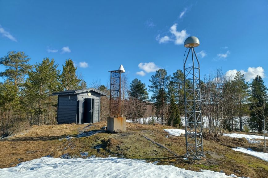
Another new feature is the increased number of base stations used for FINPOS. Until now, data has been available from FinnRef stations, and now, in addition to these, there are about 40 FINPOS base stations which have been established primarily for the needs of positioning services. A denser base station network enables, among other things, more accurate and reliable location solutions for the end user of the service.
– We hope that by renewing our services we will promote the more common use of precise positioning, and that as many people as possible will benefit from a more comprehensive base station network. Supporting research and development by providing services is also important to us, says senior specialist Topi Rikkinen from the National Land Survey of Finland.
How innovations are visible in services
The FINPOS service will continue to offer similar services as before: station raw data as RINEX files for post-processing or other uses, real-time raw data as RTCM data streams, and real-time positioning using DGNSS or network RTK correction.
The DGNSS and RINEX services are open and free of charge. The RTK service is available for fixed-term research and development use free of charge. The use of the raw data service is subject to a charge.
The RTK service now also provides so-called SSR correction data. Like network RTK, SSR is a method for precise real-time positioning. The use of SSR methods is becoming increasingly widespread, and such data will also be available from the EU Galileo High Accuracy Service (HAS) at the end of 2022.
Instructions for accessing the service
Anyone interested in using the new services can create a FINPOS user account. The user account allows access to RINEX and DGNSS services. If the user wants temporary access to RTK/SSR services, the website can be used to send information about the need for use, so that the access can be granted.
More information about the services is available on the website
Additional information:
Topi Rikkinen, senior specialist, +358 50 323 5276, firstname.lastname@nls.fi