Technical description (WMS)
The Map image service's WMS interface is based on the WMS 1.3.0 standard (Web Map Service) and available at:
https://sopimus-karttakuva.maanmittauslaitos.fi/sopimus/service/wms
The metadata description of the service is available by making a service request:
The service supports the ETRS-TM35FIN coordinate system for all data materials. Except for the basic map, the service also supports ETRS-GKnn coordinate systems in various zones.
You need an agreeement with the National Land Survey to use the service. If you are interested in signing a contract, email the web service customer support at verkkopalvelut@maanmittauslaitos.fi.
The datasets (products) are provided free of charge, although we charge a maintenance fee for the use of the service.
Performance
In principle, the WMTS interface has a clearly better performance than the WMS interface because the former buffers the map images in accordance with a map tile model.
In the WMS interface, the most efficient format for transfers depens on the dataset (and on the requirements of the specific application):
- PNG (format=image/png)
- Usually the best format for downloading datasets, with the exception of orthophotos. For these datasets, the service also supports the transparent PNG-format (with the parameter transparent=true). Downloading transparent PNG-images (32 bits) takes slightly longer than non-transparent PNG-images (24 bits), which means that the value of the transparent parameter can affect performance.
- If orthophotos are downloaded in PNG format, the default files are 8 bit PNG images.
- JPEG (format=image/jpeg)
- We recommend the JPEG format for downloading orthophotos. This ensures the smallest image file size and fastest data transfers.
The selected coordinate system can have an impact on the service's response time:
- ETRS-TM35FIN (crs=EPSG:3067)
- The performance is identical for all datasets.
- ETRS-GKnn (crs=EPSG:3873 ... crs=EPSG:3885)
- The response times for topographic and background map datasets are slower than when downloaded in the ETRS-TM35FIN coordinate system.
- For orthophoto data sets the performance is equivalent to the ETRS-TM35FIN coordinate system.
Sources and products
The following datasets are available from the service:
- Basic, Topographic and General map rasters (topographic map)
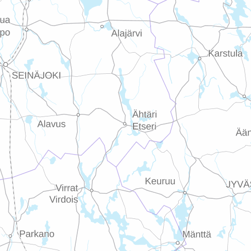
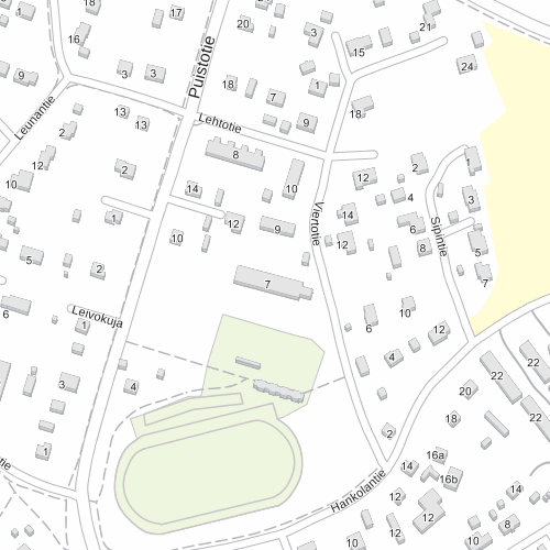
- Bacground map series (background map)
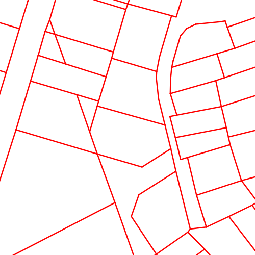
- Property division
- Orthophotos
In this context, dataset means a map layer in WMS (layers parameter). For all datasets, the following colour styles are supported (WMS styles parameter):
- no parameter - dataset default colours
- light - raster dataset shown in slightly lighter colours
The following datasets are available from the service:
| Dataset identifier | Supported coordinate systems | Supported exit resolutions |
| taustakartta (background map) | TM35FIN, GKnn, WGS84/Pseudo-Mercator | 0.5 m, 1 m, 2 m, 4 m, 8 m, 16 m, 32 m, 64 m, 128 m, 256 m, 512 m, 1024 m, 2048 m, 4096 m |
| maastokartta (topographic map) | TM35FIN, GKnn, WGS84/Pseudo-Mercator | 0.5 m, 1 m, 2 m, 4 m, 8 m, 16 m, 32 m, 64 m, 128 m, 256 m, 512 m, 1024 m, 2048 m, 4096 m |
| peruskartta_taustavari (basic map, background colour) | TM35FIN | 1 m |
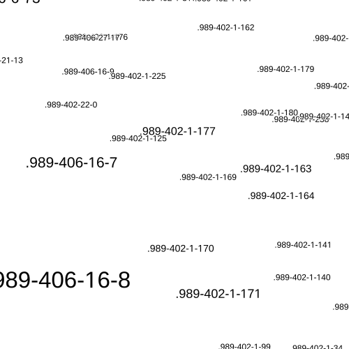
| kiinteistojaotus (property boundaries) | TM35FIN ja GKnn | 0.5 m, 1 m, 2 m, 4 m |
| kiinteistotunnukset (property identifiers) | TM35FIN ja GKnn | 0.5 m, 1 m, 2 m, 4 m |
| ortokuva (orthophoto) | TM35FIN, GKnn, WGS84/Pseudo-Mercator | 0.25 m, 0.5 m, 1 m, 2 m, 4 m, 8 m, 16 m, 32 m, 64 m, 128 m, 256 m, 512 m, 1024 m, 2048 m, 4096 m |
| ortokuva:vaaravari (orthophoto, false colour) | TM35FIN, GKnn, WGS84/Pseudo-Mercator | 0.25 m, 0.5 m, 1 m, 2 m, 4 m, 8 m, 16 m, 32 m, 64 m, 128 m, 256 m, 512 m, 1024 m, 2048 m, 4096 m |
| ortokuva_metsaorto (orthophoto, forest) | TM35FIN, GKnn, WGS84/Pseudo-Mercator | 0.25 m, 0.5 m, 1 m, 2 m, 4 m, 8 m, 16 m, 32 m, 64 m, 128 m, 256 m, 512 m, 1024 m, 2048 m, 4096 m |
| ortokuva_luonnontuho (orthophoto, environmental destruction) | TM35FIN, GKnn, WGS84/Pseudo-Mercator | 0.25 m, 0.5 m, 1 m, 2 m, 4 m, 8 m, 16 m |
| ortokuva_aikasarja (orthophoto, time series) | TM35FIN, GKnn, WGS84/Pseudo-Mercator | 0.25 m, 0.5 m, 1 m, 2 m, 4 m, 8 m, 16 m |
| ortokuva_kuvausvuosi (orthophoto, year of photography) | TM35FIN, GKnn, WGS84/Pseudo-Mercator | 0.5 m, 1 m, 2 m, 4 m, 8 m, 16 m, 32 m |
ortokuva (orthophoto)
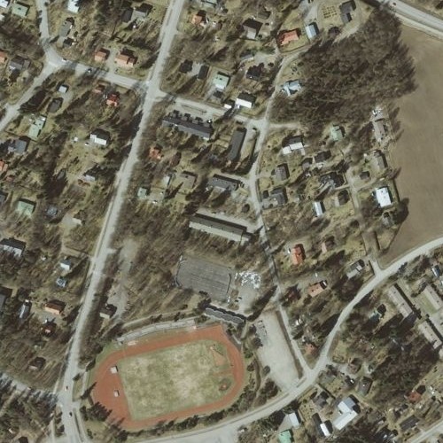
- Colour orthophotos covering areas photographed within the Finnish aerial photography programme (resolution 0.5 m, digital camera etrs-tm35fin). Colour orthophotos are available from 2008 onwards.
- Monochrome orthophotos that have been produced for the National Land Survey's Topographic Database (resolution 0.5 m, 1:20,000 aerial photography, film camera, etrs-tm35fin). These aerial photographs have been taken in 2008 and 2009.
- Monochrome orthophotos that have been produced for the National Land Survey's Topographic Database (resolution 0.5 m, 1:16,000 or 1:31,000 aerial photography, film camera, kkj). These aerial photographs were taken until 2007.
- The Topographic Service's OrtoCD dataset (1 m resolution, 1:60,000 aerial photography, film camera, kkj).
- Orthophotos made from historical aerial photographs from the 1930s onwards. The original scale and other technical properties of the photos vary. Generally, the resolution is equivalent to a 0.5–1.0 m pixel size.
ortokuva_aikasarja (orthophoto, time series)
- The map level Ortokuva_aikasarja is intended to make it easier to find orthophotos based on the year they were photographed.
- When the area shown on the map is large, the map level does not contain the orthophotos themselves, rather the locations from which orthophotos exist for the selected time period. The orthophotos will be shown when you zoom in on the map.
- The data contents of this map layer is otherwise identical to the orthophoto layer.
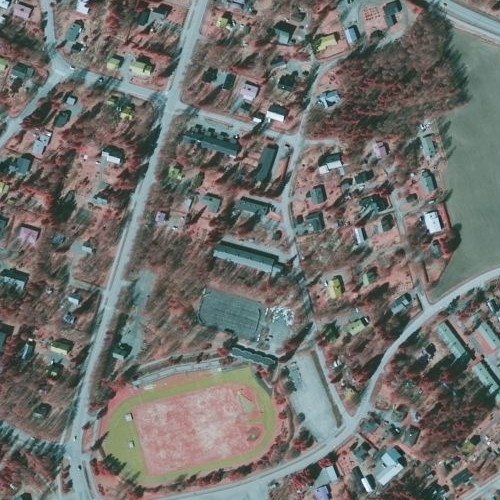
ortokuva_vaaravari (orthophoto, false colour)
- Colour orthophotos covering areas photographed within the Finnish aerial photography programme (resolution 0.5 m, digital camera etrs-tm35fin). Such orthophotos exist from 2008 onwards.
- False colour orthophotos that have been produced for the National Land Survey's Topographic Database (resolution 0.5 m, 1:20,000 aerial photography, film camera, etrs-tm35fin). Such photographs were taken covering a small area in 2008.
- False colour orthophotos that have been produced for the National Land Survey's Topographic Database (resolution 0.5 m, 1:31,000 aerial photography, film camera, kkj). These aerial photographs were taken until 2008. Lapland is the main area covered by these orthophotos.
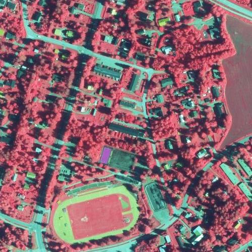
ortokuva_metsaorto (orthophoto, forest)
- Similar to ortokuva_vaaravari, but the red-green colour palette has been adjusted so that coniferous and deciduous trees are more distinguishable.
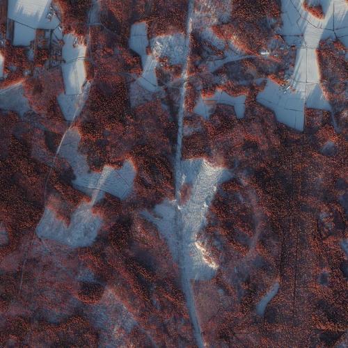
ortokuva_luonnontuho (orthophoto, environmental destruction)
- orthophotos that are used in evaluations of environmental destruction
- same properties as orthophotos
- very low coverage
ortokuva_kuvausvuosi (orthophoto, year of photography)
- This map layer shows a grid with information about when the most recent orthophoto covering that grid was taken.
Metadata interfaces for orthophotos
GetFeatureInfo
The GetFeatureInfo request returns additional information about orthophotos covering the selected area. With the GetFeatureInfo request, the client application can get information about which orthophoto datasets are used in detaching a raster image that has been defined using a particular GetMap definition.
WFS metadata interface
Queries via the WFS metadata interface return information about the year orthophotos were taken from the selected area.
Queries and examples
With the user-ID and password sent by online services customer support you can access the service using the request GetCapabilities.
The WMS service has the following limitations as described in the metadata description:
| Rajoite | Arvo | Selite |
|---|---|---|
| Fees | In accordance with contract | See The webpage of the Map image service contains more detailed information. |
| AccessConstraints | Requires user-ID | Authentication in accordance with HTTP Basic Auth. |
| LayerLimit | 1 | GetMap requests only use the first dataset identifier that has been noted in the layers parameter (if you want to use more than one map layer, each layer requires its own GetMap request). |
| MaxWidth | 3192 | The maximum width of an image in pixels. Please note that the size of the image may affect the response time of requests, a smaller image downloads faster. |
| MaxHeight | 2048 | The maximum height of an image in pixels. |
Examples of GetMap requests
Topographic map as a PNG image (pixel size 1 metre):
Request for transparent PNG (pixel size 0.5 metres) of property division (property boundaries):
Orthophoto request in JPEG-format from the most recent orthophoto dataset:
Orthophoto request in JPEG-format with a defined time period (here TIME=1999/2005 defines the period):
For more GetMap request examples from various datasets, see below under Examples
Metadata interfaces
GetFeatureInfo examples:
ortokuva (orthophoto):
ortokuva, vääräväri (Orthophoto, false colour):
OGC API Features
In addition to the WMS standard's GetFeatureInfo requests, orthophoto metadata is also available from a metadata interface that is compatible with the OGC API Features standard:
Landing page:
https://sopimus-karttakuva.maanmittauslaitos.fi/metadata/features/v1
Conformance classes:
https://sopimus-karttakuva.maanmittauslaitos.fi/metadata/features/v1/conformance
Open API description:
https://sopimus-karttakuva.maanmittauslaitos.fi/metadata/features/v1/api
List of features:
https://sopimus-karttakuva.maanmittauslaitos.fi/metadata/features/v1/collections
Examples of requests via the OGC API Features interface:
Version management
2024/01 Production update 2 January 2024
A new aerial photograph product available, forest orthophoto. The product is similar to a false colour orthophoto, where the red-green colour palette has been adjusted so that coniferous and deciduous trees are more distinguishable. The wishes of forest experts have been taken into account in product development.
2023/12 Production update 11 December 2023
Version update of the WMS interface for the Map image service (WMS) map images
- technical changes
- URL changes may require modifications in client systems
Version update of the OGC API Features interface of the Map image service (WMS) metadata
2020/10 Production update 23 October 2020
The WFS 3.0 draft standard-compliant orthophoto metadata interface in the Map image service (WMS) has been updated to comply with the "OGC API Features" standard. We continue to support the old version but recommend using the new version of the metadata interface.
Orthophoto metadata remains available via the WMS GetFeatureInfo query.
2019/05 Production update 13 May 2019
The service has been taken into use on 13 May 2019 and now the maintenance of the service carries a charge. The datasets are free of charge.
2019/03 BETA-release 21 March 2019
The second BETA version of the service taken into use 21 March 2019. Changes:
- improved performance
- ETRS-GKnn support for orthophotos, topographic maps and background maps
smaller fixes and additions
2018/06 BETA release
The first BETA version of the service taken into use.
Examples
Examples of GetMap requests
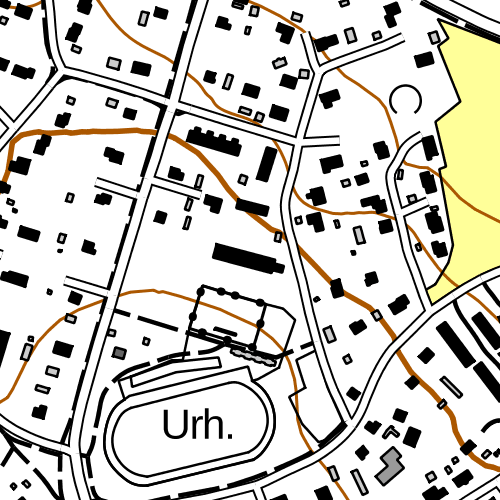
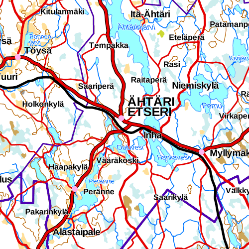
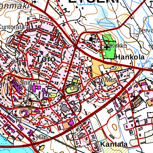
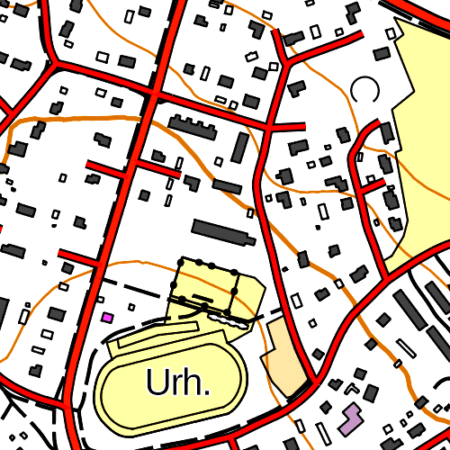
Each example contains the GetMap request URL and the response image (PNG or JPEG image). The responses have been coded as static copies on this example page and they are not being fetched dynamically from the interface.
Topographic map
A topographic map is a combination layer cosisting of basic, topographic or general maps. The topographic map layer returns a fitting map depending on the resolution of the request (the values of the BBOX, WIDTH and HEIGHT parameters).
Topographic map, resolution 32 m/px
Topographic map, resolution 4 m/px
Topographic map, 1 m/px, styles=light
Background map
Background map 256 m/px
Background map 1 m/px
Property information
Property division
0.5 m/px
Property identifiers
0.5 m/px
Orthophotos
Orthophoto
1 m/px
Orthophoto, false colour
1 m/px
Orthophoto, forest
1 m/px
Orthophoto, environmental destruction
1 m/px
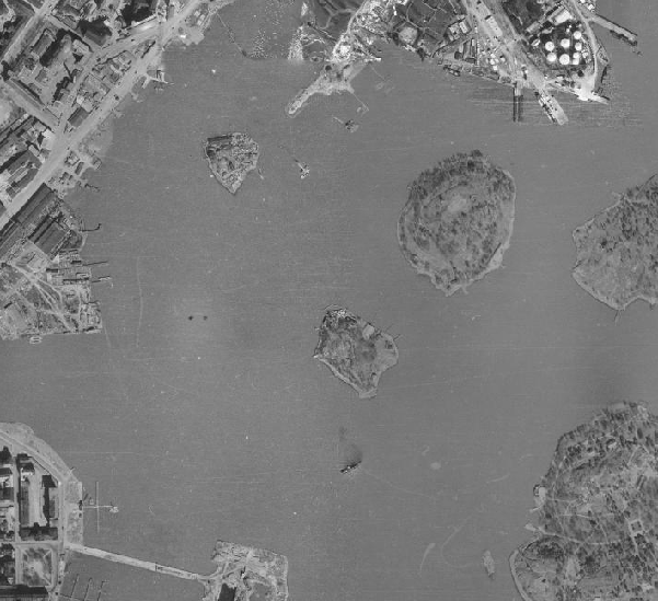
ortokuva_aikasarja (orthophoto, time series)
Aerial photograph, time series, year of photography 1950
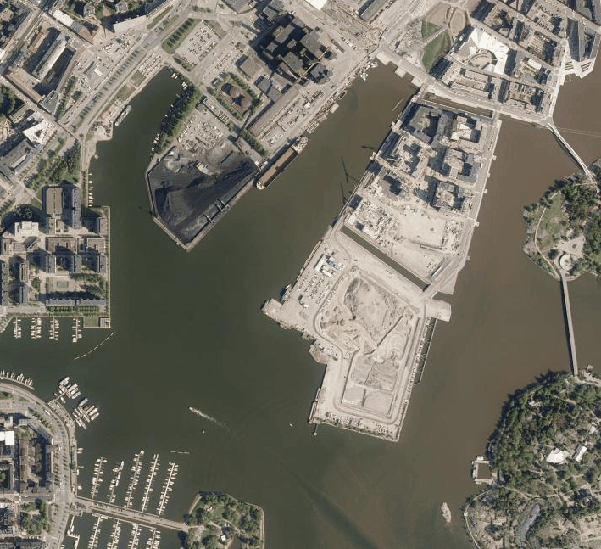
ortokuva_aikasarja (orthophoto, time series)
Aerial photograph, time series, year of photography 1950
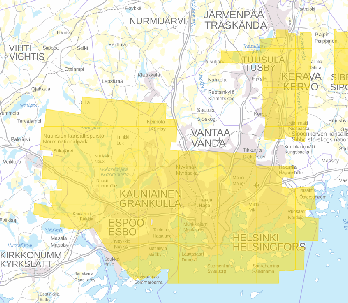
ortokuva_aikasarja (orthophoto, time series)
Year of photography 1950, small scale view
Basic map
peruskartta_taustavari (basic map, background colour)
1 m/px
