Technical description (WMTS)
The service is based on the WMTS 1.0.0 standard (Web Map Tile Service). The service supports KVP and REST encoding as well as GetCapabilities and GetTile operations (in compliance with both KVP and REST encoding). GetFeatureInfo is not supported.
When customers with a contract log in to the map image service, the WMTS client application uses the following addresses that are in accordance with the service's metadata description:
topographic maps:
https://karttakuva.maanmittauslaitos.fi/maasto/wmts/1.0.0/WMTSCapabilities.xml
property boundaries:
https://karttakuva.maanmittauslaitos.fi/kiinteisto/wmts/1.0.0/WMTSCapabilities.xml
thematic maps:
https://karttakuva.maanmittauslaitos.fi/teema/wmts/1.0.0/WMTSCapabilities.xml(thematic maps).
The metadata description includes information such as the service addresses that are used to connect the client application with the interface. The application establishing the connection must get the up-to-date descriptions directly from the service. You can get the required user IDs from the web service customer support.
Property boundaries and identifiers are updated in the service daily to match the status of the Cadastre. For the status of the update, use the query https://karttakuva.maanmittauslaitos.fi/wmtstilanne/kiinteisto.xml, the response is interpreted as follows:
- Monday–Saturday: when the rekisteritilannepvm (registry updating date) is the same as the query date and the variable rekisteritilanneAjantasalla is true, the data in the service is up to date.
- Sunday: when the rekisteritilannepvm (registry updating date) is the same as the previous day's date and the variable rekisteritilanneAjantasalla is true, the data in the service is up to date.
Performance
For optimal performance, it is recommended to buffer the map images in the customers' proxy or application servers. This can be done with the HTTP subject fields included in every response returned by the service (Expires, Cache-Control):
Expires: Tue, 01 Oct 2013 09:04:26 GMT
Cache-Control: public, max-age=86400
Typically, proxy servers that support buffering can use this data directly. Alternately, you can buffer the map images for a week.
We also recommend forwarding the Expires and Cache-Control subject fields directly to the end-users' web browsers in web applications to allow them to cache the map images.
The performance of the service also depends on the data and scale levels that are used. For example, for Topographic map and Background map products the best response time is provided at the scale levels 0‒13. If the application accessing the service needs the same response time for the most detailed scale levels 14–15, we recommend using map tiles in scale level 13 (resampled) even at these levels if the customer software allows it.
Open interface connection
The access connection to the openly available Map tile service (WMTS) metadata description is https://avoin-karttakuva.maanmittauslaitos.fi/avoin/wmts/1.0.0/WMTSCapabilities.xml.
The metadata description includes information such as the service addresses that are used to connect the client application with the interface. The application establishing the connection must get the up-to-date descriptions directly from the service. Using the open interface service requires an API key. More information about how to use the API key.
The open Map image service (WMTS) is intended for testing the interface and for small-scale use, where the performance of the service is not critical. The product range provided via the open Map image service (WMTS) is smaller and the zoom levels are less precise.
Sources and products
Aineistot ja tuotteet -osiossa on ensin kuvattu sopimuksellisen rajapintapalveluun aineistot. Jäljempänä on esitelty avoimen rajapintapalvelun aineistot.
maasto-alipalvelu:
| Material ID | Name | Format | Supported JHS levels | Product description |
| maastokartta | Maastokartta (topographic map) | PNG8 |
ETRS-TM35FIN: levels 0-15 ETRS-GK 19-31: levels 0-15 WGS84 Pseudo-Mercator: levels 0-18 |
|
| taustakartta | Taustakartta (Background map) | PNG8 |
ETRS-TM35FIN: levels 0-15 ETRS-GK 19-31: levels 0-15 WGS84 Pseudo-Mercator: tasot 0-18 |
Background map raster series |
| selkokartta | Selkokartta (Plain map) | PNG8 |
ETRS-TM35FIN: levels 0-15 ETRS-GK 19-31: levels 0-15 WGS84 Pseudo-Mercator: tasot 0-18 |
|
| ortokuva | Ortokuva (Orthophoto) | JPEG |
ETRS-TM35FIN: levels 0-15 ETRS-GK 19-31: levels 0-15 WGS84 Pseudo-Mercator: tasot 0-18 |
|
| ortokuva_vaaravari | Ortokuva, vääräväri (Orthophoto, false colour) | JPEG |
ETRS-TM35FIN: levels 0-15 ETRS-GK 19-31: levels 0-15 WGS84 Pseudo-Mercator: levels 0-18 |
|
| ortokuva_metsaorto | Metsäorto (Orthophoto, forest) | JPEG |
ETRS-TM35FIN: levels 0-15 ETRS-GK 19-31: levels 0-15 WGS84 Pseudo-Mercator: levels 0-18 |
|
| korkeusmalli_vinovalo | Rinnevarjoste korkeusmalli (Hillshade, elevation model) | PNG8 | ETRS-TM35FIN: levels 0-15 |
|
| korkeusmalli_korkeusvyohyke | Korkeusvyöhykkeet (Elevation zones) | PNG8 | ETRS-TM35FIN: levels 0-15 |
|
A topographic map is a combination of basic, topographic or general map materials. A background map is a combination of materials from a background map series. A plain map is a combination of levels consisting of map materials from the plain map series. The original material for the combined maps has been selected according to their scale to ensure that they are suitable for a certain JHS level. An orthophoto consists of colour and monochrome photographs of different ages (the most recent ones available for each region), levels 1–9 of the orthophoto mosaic.
The hillshade elevation model has been calculated from the elevation model 2 m and 10 m datasets. Levels 11–15 of the hillshade have been calculated from the Elevation model 2 m dataset. Other levels of the hillshade have been calculated from the Elevation model 10 m dataset. The elevation zone data has been calculated from the Elevation model 10 m dataset.
properties subservice:
| Material ID | Name | Format | Supported JHS levels | Additional information |
| kiinteistojaotus | Property division |
PNG8 |
ETRS-TM35FIN: JHS levels 10-15 ETRS-GK 19-31: levels10-15 WGS84 Pseudo-Mercator: levels 12-18 |
Transparent PNG The dataset is updated every day and matches the status of the Cadastre. |
| kiinteistotunnukset | Property identifiers | PNG8 |
ETRS-TM35FIN: JHS levels 10-15 ETRS-GK 19-31: levels 10-15 WGS84 Pseudo-Mercator: levels 12-18 |
Transparent PNG The dataset is updated every day and matches the status of the Cadastre. |
theme subservice:
| Material ID | Name | Format | Supported JHS levels | Additional information |
| kuntarajat | Municipal borders | PNG8 | ETRS-TM35FIN: JHS levels 0 - 15 | Transparent PNG |
| kuntatunnukset | Municipal identifiers | PNG8 | ETRS-TM35FIN: JHS levels 0 - 15 | Transparent PNG |
| paikannimet | Place names in Basic map raster | PNG8 | ETRS-TM35FIN: JHS levels 0 - 15 | Transparent PNG |
| hallinnolliset_yksikot | Administrative units in Basic map raster | PNG8 | ETRS-TM35FIN: JHS levels 0 - 15 | Transparent PNG |
| liikenneverkot | Traffic networks in Basic map raster | PNG8 | ETRS-TM35FIN: JHS levels 0 - 15 | Transparent PNG |
| hydrografia | Hydrography in Basic map raster | PNG8 | ETRS-TM35FIN: JHS levels 0 - 15 | Transparent PNG |
| korkeus | Elevation in Basic map raster | PNG8 | ETRS-TM35FIN: JHS levels 0 - 15 | Transparent PNG |
| maanpeite | Land cover in Basic map raster | PNG8 | ETRS-TM35FIN: JHS levels 0 - 15 | Transparent PNG |
| maankaytto | Constructions in Basic map raster | PNG8 | ETRS-TM35FIN: JHS levels 0 - 15 | Transparent PNG |
| rakennukset | Constructions in Basic map raster | PNG8 | ETRS-TM35FIN: JHS levels 0 - 15 | Transparent PNG |
| osoitteet | addresses – road names in the Topographic Database and addres numbers for buildings in the Population Information System. | PNG8 | ETRS-TM35FIN: JHS levels 0 - 15 | Transparent PNG |
| TM35_lehtijako | TM35 map-sheet division | PNG8 | ETRS-TM35FIN: JHS levels 0 - 15 | Transparent PNG |
Open interface connection
The open Map image service (WMTS) is intended for testing the interface and for small-scale use, where the performance of the service is not critical. The following products are provided via the Open Map image service (WMTS): Topographic map, Background map, Plain map and Orthophoto. The products are provided in the following coordinate reference systems and zoom levels. More detailed zoom levels require an agreement to use the WMTS service. See further information above.
| Product | Supported reference systems: |
Provided zoom levels: ETRS-TM35FIN |
Provided zoom levels: WGS84 Pseudo-Mercator |
|---|---|---|---|
| Topographic map | ETRS-TM35FIN, WGS84 Pseudo-Mercator | 0-13 | 0-16 |
| Background map | ETRS-TM35FIN, WGS84 Pseudo-Mercator | 0-13 | 0-16 |
| Property boundaries | ETRS-TM35FIN, WGS84 Pseudo-Mercator | 10-13 | 12-16 |
| Property identifiers | ETRS-TM35FIN, WGS84 Pseudo-Mercator | 10-13 | 12-16 |
| Plain map | ETRS-TM35FIN, WGS84 Pseudo-Mercator | 0-13 | 0-16 |
| Orthophoto (most recent) | ETRS-TM35FIN, WGS84 Pseudo-Mercator | 0-13 | 0-16 |
The open interface connection can be used freely and the service does not require user authentication. The performance of the service has been limited. If the service receives too many simultaneous requests, some requests will be rejected (503 SERVICE UNAVAILABLE). No user support is provided for the service and the National Land Survey does not guarantee that the service is either available or accessible. Information about changes to the service will be published on the service's web page.
Queries and examples
The page includes a downloadable demo version of the Map Service (WMTS), GetCapabilities searches and some examples of map image searches with the interface.
Demo application
Click this link to download the demo application and an example of how you can use the Map image service (WMTS). Extract the file from the compressed folder: the folder including the kartta.html file should also include a library called proj4js. The compressed folder contains a copy of the library. You can download the original file from http://trac.osgeo.org/proj4js/. Users of the demo application must make sure that the license of the Proj4js library complies with the way the application is used.
Please note that the demo app refers to the open interface connection when requesting WMTS map tiles (service addresses start with https://avoin-karttakuva.maanmittauslaitos.fi). If you modify the demo app to reference the interface connection for agreement-based users (service addresses start with https://karttakuva.maanmittauslaitos.fi), the WMTS requests from the demo user interface require Basic Auth authentication. This can be challenging for browser app users and in these situations we recommend proxying WMTS requests via a server providing the user interface website.
Map tile calculations
A description of the calculation of map tiles in Finnish map tile models is in the JHS recommendation JHS 180 Paikkatiedon sisältöpalvelut, Liite 1 Karttakuvapalvelut (Content services for spatial data, Appendix 1 Map tile services; only available in Finnish). Download appendix 1.
Briefly the map tiles for the ETRS-TM35FIN coordinate system:
1) Starting point: xMIN=-548576, yMAX=8388608
2) tile row: (yMAX-y) / (256 * <jhs-level resolution> + 0.5), where y is the E coordinate of the point.
3) tile column: (x - xMIN) / (256 * <jhs-level resolution> + 0.5), where x is the N coordinate of the point.
em. kohdissa 2 ja 3 jakaja katkaistaan kokonaisluvuksi.
jhs-level resolutions: on level 13 it is 1 (metre) and on smaller levels it is the previous level multiplied by two (for example jhs12 2, jhs11 4, jhs10 8) and larger dividided by 2 (for example jhs14 0.5).
WGS84 Pseudo-Mercator map projection: xMIN-20037508.3427892480, yMAX=20037508.3427892480
GetCapabilities searches from the interface
Customers with a contract:
There are two methods for doing GetCapabilities searches: KVP and REST. Here are both methods for topographical, property and theme rasters:
https://karttakuva.maanmittauslaitos.fi/maasto/wmts/1.0.0/WMTSCapabilities.xml
https://karttakuva.maanmittauslaitos.fi/kiinteisto/wmts/1.0.0/WMTSCapabilities.xml
https://karttakuva.maanmittauslaitos.fi/teema/wmts/1.0.0/WMTSCapabilities.xml
Open interface service:
https://avoin-karttakuva.maanmittauslaitos.fi/avoin/wmts/1.0.0/WMTSCapabilities.xml
Examples of map image searches from the interface
Each example contains the request URL in REST and KVP formats and the response image (PNG8 or JPEG image). The responses have been coded as static copies on this example page and they are not being fetched dynamically from the interface.
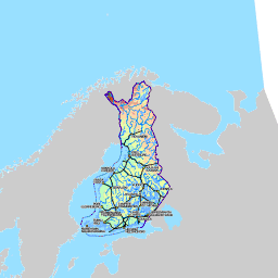
Topographic map JHS level 0
Customers with a contract:
Open interface service
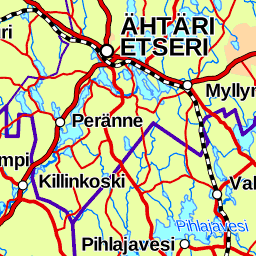
Topographic map JHS level 6
Customers with a contract:
Open interface service:
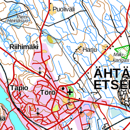
Topographic map JHS level 9
Customers with a contract:
Open interface service:
Topographic map JHS level 12
Customers with a contract:
Open interface service
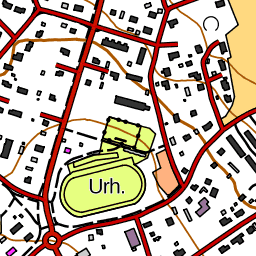
Background map JHS level 3
Customers with a contract:
Open interface service::
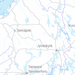
Background map JHS level 11
Customers with a contract:
Open interface service:
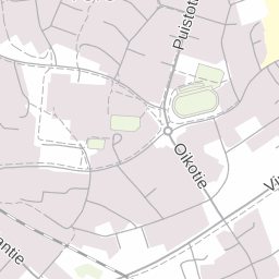
Plain map JHS level 6
Customers with a contract:
Open interface service:
Orthophoto JHS level 13
Customers with a contract:
Open interface service:
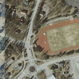
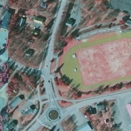
Orthophoto (false colour) JHS level 13
Customers with a contract:
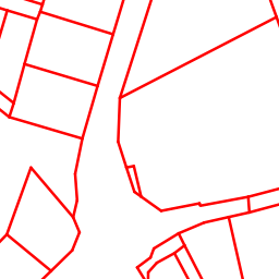
Property boundaries JHS level 13
Customers with a contract:
Open interface service:
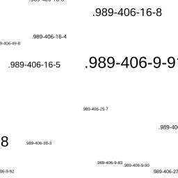
Property identifiers JHS level 13
Customers with a contract:
Open interface service:
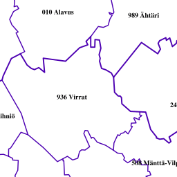
Municipal borders JHS level 5
Customers with a contract:
https://karttakuva.maanmittauslaitos.fi/teema/wmts/1.0.0/kuntarajat/default/ETRS-TM35FIN/5/22/13.png
Municipal identifiers JHS level 5
Customers with a contract:

Constructions JHS level 13
Customers with a contract:

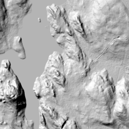
Elevation model hillshade JHS level 11
Customers with a contract:
Version management
Product modification 2023-06-27
Added kiinteistojaotus and kiinteistotunnus to the ETRS-TM35FIN zoom level 10 (contract and open), WGS84 Pseudo-Mercator zoom level 12 (contract and open) ja ETRS-GK 19-31 zoom level 10 (contract) 2023-06-27.
Product modification 2023-06-07
Added Forest orthophoto (ortokuva_metsaorto) 2023-06-07
Production version 2015-11 modification
The product Hillshade point cloud has been discontinued in the Map tile service (WMTS) interface 2022-10-24
Production version 2015-11 extension
The product Hillshade point cloud has been introduced to customers with a contract to use Map image service (WMTS) on 22.02.2022
- ”Rinnevarjoste pistepilvi” (name, Hillshade point cloud), dataset identifier rinnevarjoste_pistepilvi
and naming changes - ”Rinnevarjoste korkeusmalli” (name Hillshade elevation model, current "Korkeusmalli vinovalovarjoste"), dataset identifier korkeusmalli_vinovalovarjoste remains unchanged
- ”Korkeusvyöhykkeet” (name Elevation zones, current ”Korkeusmalli korkeusvyohyke”), dataset identifier korkeusmalli_korkeusvyohyke remains unchanged
Production version 2015-11 extension
Plain map: coordinate system support has been extended to include the WGS84 Pseudo-Mercator map projection 10.3.2021, ETRS-GKnn zones have also been added. Orthophotos and false colour orthophotos: coordinate system support has been extended to include the WGS84 Pseudo-Mercator map projection 16.3.2021
Production version 2015-11 extension
Municipal borders and identifiers: datasets will be reformed on 4.6.2018, the municipal borders dataset will include municipal identifiers.
Production version 2015-11 extension
Coordinate system support for the Background map series and the Topographic Map series in the Map image service (WMTS) has been extended to include the ETRS-GK19-31 coordinate systems and the WGS84 Pseudo-Mercator map projection 7.11.2017.
The tile matrix of the ETRS-GK19-31 coordinate system according to which the map images are provided in the WMTS service will be updated in the JHS update project. The updating project launches on 11/2017 and the planned completion date is 02/2019. The coordinate system support of the Map image service (WMTS) for the ETRS-GK19-31 coordinate systems will be provided as BETA until the update of the JHS-180 recommendation is complete. The service may be modified when it is available as a BETA release.
The coordinate system support for the WGS84 Pseudo-Mercator map projection will be provided as BETA until 02/2018. The service may be modified when it is available as a BETA release.
Production version 2015-11 extension
Plain map introduced as a new product 11.10.2017..
Production version 2015-11 extension
New background map (new imaging technique) 6.6.2017.
Production version 2015-11 extension
Orthophoto levels 1–6 deployed 13.6.2016.
Production version 2015-11
Version 2015-11 deployed 24.11.2015:
New products were taken into use
- municipal borders in the themes subservice
- municipal identifiers in the themes subservice
- hillshade elevation model in the topographic subservice
- elevation model elevation zones in the topographic subservice
Production version 2015-03 extension
On the background map levels 13–15 the description of road names has been modified on 2015-04-10 so that the road names are drawn in accordance with the majority language of the municipality.
Version 2015-03
deployed 2015-03-03:
Improved appearance of property boundary products
The imaging method of the products property division oand property identifiers has been altered slightly. The sharpness of property identifiers was improved and the line depiciting property boundaries was thickened slightly.
New theme products introduced:
Addresses (NLS road names and the building address numbers from the Population Register Centre's Population Information System.
TM35 map sheet division (in accordance with the JHS 154 recommendation, showing sheet sizes 1:200 000–1:5 000.
Partial elements of the basic map where the imaging technique are in accordance with the Basic map.
- Place names (those that are shown on the Basic map)
- Administrative units (borders of municipalities, regions, Regional State Administrative Agencies and the national border of Finland)
- Traffic networks (roads, railways, waterways, airports)
- Hydrography (seas, lakes, rivers, springs, rough bogs, water areas silting up, shallows)
- Elevation (altitude countours, depth contours, precipices)
- Land cover (water, agricultural land, soil extraction areas, parks, bogs, forest land, rock, stony ground, sands, airports, ground vehicle traffic areas)
- Land use (water, agricultural land, soil extraction areas, cemeteries, storage areas, parks, waste dumps, airports, ground vehicle traffic areas)
- Constructions (residential, business and holiday buildings, industrial, religious, public buildings, other buildings and constructions)
Old theme products removed
These new theme products in Map image service (WMTS) are replacing the current theme products in Map image service (WMS): (Place names, Administrative borders,Constructions, Traffic network, Hydrography,Fields, Open forests,Rocky and sandy areas, Contours,Swamps, Road names,The address numbers in the Population Information System maintained by the Population Register Centre). Old theme products will be removed later this spring.
Production version 2014-12
Production version 2014-12 deployed 2014-12-16:
- A new production process was taken into use in the Background map product: the source data of some jhs-levels changed.
- Production received more powerful servers.
Production version 2014-10
Production version 2014-10 deployed 2014-10-09:
- A new production process was taken into use in the Topographic map product: the source data of some jhs-levels changed.
- Orthophoto (false colour) (ortokuva_vaaravari) introduced.
Production version 2013-09
Production use started on 24.9.2013.
Test version
The test version was deployed on 19.06.2013.
The service is based on the WMTS 1.0.0 standard (Web Map Tile Service). The service supports KVP and REST encoding.
The map service (WMTS) includes the following products:
- background map
- topographic map
- orthophoto
- property division
- property identifiers.


