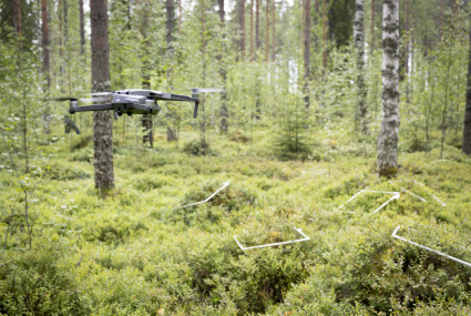
Fresh study reveals Finland's best berry picking spots
Finland’s forests are a veritable treasure trove for berry pickers. However, finding the spots with the best hauls is difficult. Our study creates berry maps by combining growth location data, geospatial data and laser scanning to find the best spots.
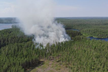
Drones trained to put out forest fires
AI-based technology for detecting and preventing forest fires is under development in a project headed by the National Land Survey of Finland’s Finnish Geospatial Institute (FGI). In future, drones and artificial intelligence may help with suppressing fires.

Measurements ensure that no privately owned trees are felled
This summer, the Centre for Economic Development, Transport and the Environment (ELY) of North Savo will cut roadside trees over some 250 kilometres to improve traffic safety. Some roads will be repaved while others will undergo structural improvements. The National Land Survey of Finland (NLS) will mark the boundaries of road areas.

Which interface should I choose – contractual or open access?
The National Land Survey of Finland’s (NLS) open datasets are provided through contractual services subject to a separate charge and through open access interfaces free of charge. Is there any difference, and which service should I choose?

Booking appointments to be tested at some National Land Survey service points
At six National Land Survey service points, customer service by appointment will be tested in summer 2024.