Cross-organisational Ferox project makes use of autonomous drones, the national laser scanning dataset, geospatial data as well as image-based computer vision to collect information about berry harvests. The collected data is used to create artificial intelligence models that can assess where the best berry spots might be.
Finding berries with artificial intelligence
In addition to drones, bilberry harvests have been studied through smartphone photos with an application that automatically counts the number of berries. This deep-learning application was developed for this purpose, to identify berries growing from the shrub. Local orienteering clubs have helped with collecting these photographs.
The data, collected from the experiment sites, is combined with data on the berries growth environment, such as the forest and soil type as well as light conditions, which is available from various datasets. Based on these, it is possible to create highly detailed models of the best bilberry spots and the harvests therein. Due to the short duration of the project, annual differences in the harvest are not included.
A lot of value in the spots with the best harvest
This summer, field work has taken places in the Nuuksio area in particular, with previous work having been done in Ilomantsi. Based on the material, the bilberry spots have been placed in four categories, with the highest category for the best harvest covering only 0.7 per cent of Finland’s berry spots.
'Our focus is on finding the highest category spots with the best harvests. They are highly valuable for berry pickers, and finding them on your own is highly difficult without having a deep knowledge about bilberry picking,' says professor Juha Hyyppä from the Finnish Geospatial Research Institute of the National Land Survey.
'Until now, we have been studying the growth areas of bilberry, but we will be carrying out a survey of lingonberry and cloudberry harvests around Finland. Berry-pickers could particularly benefit from location data on cloudberries, which are rare and valuable, to save them both money and time,' Hyyppä continues.
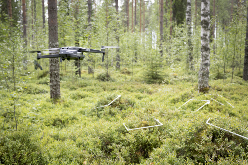
Autonomous drones that fly under the tree cover can also be used to find out which of the potentially good berry spots are actually good. The technology is still in development, but it is a promising avenue for berry entrepreneurs.
Natural berries – an individual and societal benefit
Natural berries are valuable both for individuals financially and for public health in general. Berry-picking is a fantastic outdoor activity and natural berries are a good source of nutrition. However, not everyone has easy access to good berry spots close to their summer cabin, making them travel further away as the only option. In such a case, reliable berry maps can become an inspiration to go berry-picking and help to find new spots.
'Berry map apps can be useful to both Finnish and foreign berry-pickers. It is a benefit to various operators to have easy-to-access and reliable data on the natural berry count,' says specialist Marjut Turtiainen from Arktiset Aromit ry, a participant in the project.
This summer, other applications to help with finding berry spots have been released in Finland. The goals of this study are, however, wider in scope compared to any single app.
'At the onset, we studied ways to create detailed maps of a smaller area with the help of new technologies. After that, we will be testing cost-effective ways to proliferate them without a notable decrease in map detail. In the future, similar technologies could be used for more than berry-picking,' says Juha Hyyppä.
Further information
Harri Kaartinen, Research Professor, tel. +358 29 531 4756, firstname.lastname@nls.fi
Specialist Marjut Turtiainen, Arktiset Aromit ry, tel. +358 44 493 6719, firstname.lastname@arktisetaromit.fi
FEROX is funded from the European Union’s Horizon 2020 programme. The project began in September 2022 and will last for three years.
Views and opinions expressed are however those of the authors only and do not necessarily reflect those of the European Union or Directorate-General for Communications Networks, Content and Technology. Neither the European Union nor the granting authority can be held responsible for them.
