Changes in Earth’s rotation complicate accurate global time keeping
The Earth's rotation speed (angular velocity) describes the time it takes for the Earth to make a full rotation around its axis. Although a day is commonly accepted to be 24 hours, this time can vary due to geophysical processes, such as the movement of the Earth's molten outer core, the variations in the atmosphere, and tides caused by the gravitational pull of the moon.
Leap seconds are added to the Coordinated Universal Time to keep it synchronized with Universal Time that follows Earth's rotation. From 1972, leap seconds were added almost annually until 1999. Since then, seconds have only been added four times.
Due to the increase in the Earth's rotation speed, a negative leap second is predicted to be needed in 2029. Without the melting of glaciers, this would have been required approximately three years earlier. This is a significant indication that the effects of climate change are visible even in the Earth's rotational motion – that is, in the length of the day.
Metsähovi Geogedetic Research Station will contribute to the VLBI measurements of Earth’s rotation
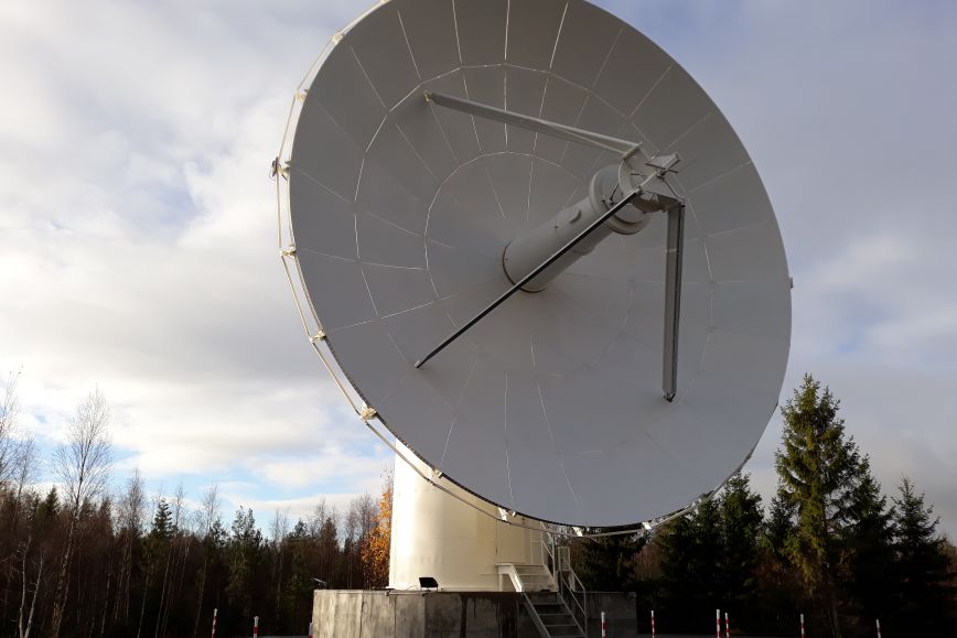
The Earth's rotation speed and its changes are measured using Geodetic Very Long Baseline Interferometry (VLBI). A global network of VLBI radio telescopes can very accurately measure the Earth's position and movement, such as its rotational angle and speed. The technique helps to maintain accurate global time standards. Precise time is required by, among others, global computer networks, communication tools, and navigation systems.
One of the VLBI telescopes is located at Metsähovi Geodetic Research Station and is maintained by the Finnish Geospatial Research Institute FGI.
– For accurate measurements of the Earth’s rotation we need a global distribution of radio telescopes observing several times a week 24 hours a day. I want to note that VLBI, along with other space geodetic techniques, maintains up-to-date international terrestrial reference frame. This is necessary for a wide range of location-based applications, such as navigation, logistics, industry and agriculture. Metsähovi Geodetic Research Station is one of the few in the world that has co-located VLBI, Satellite Laser Ranging, and a Global Navigation Satellite System. The development and maintenance of such geodetic infrastructures are crucial for society, explains specialist research scientist Nataliya Zubko from the FGI.
Both in geosciences research and many everyday applications, precise information about the Earth's rotation is needed. Satellite navigation would not function without the up-to-date information on the Earth's orientation provided by VLBI. Additionally, VLBI measurements contribute to understanding a wide range of geophysical phenomena, such as factors influencing Earth’s gravitational field.
FGI’s space geodesy group conducts research to improve the quality of VLBI observations and to ensure that the global geodetic reference frame is maintained with high accuracy in the future.
Further information
Senior scientis Nataliya Zubko, +358 29 531 4918, firstname.lastname@nls.fi

