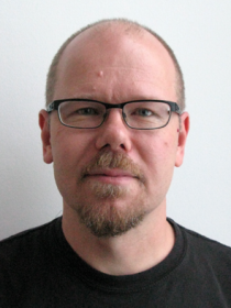
Harri Kaartinen

Member in research groups
Previous research groups
-
Environmental research with active sensors (ActiveSensing)
The research group of Environmental research with active sensors.
Read moreRead more about Environmental research with active sensors (ActiveSensing) -
Mobile mapping
The research group of mobile mapping is a mix of ubiquitous mapping experts in the field of remote sensing, photogrammetry, electrical engineering,
Read moreRead more about Mobile mapping
Contact person in projects
Previous projects
-
6Aika: Open city model as open innovation platform (AKAI)
The objective of the project is to develop an open innovative platform based on a collaborative 3D city model.
Read moreRead more about 6Aika: Open city model as open innovation platform (AKAI) -
COMBAT/Pointcloud
COMBAT/Pointcloud produces information on the use of a three-dimensional measuring technique known as laser scanning, and thereby creates preconditions for the growth of the Finnish 3D industry.
Read moreRead more about COMBAT/Pointcloud -
EuroSDR Building Extraction
The objective of the EuroSDR Building Extraction project was to evaluate the quality, accuracy, feasibility and economical aspects of semi-automatic and automatic building extraction based on laser scanner data and/or aerial images.
Read moreRead more about EuroSDR Building Extraction -
EuroSDR/ISPRS Tree Extraction
The Finnish Geodetic Institute coordinates the EuroSDR/ISPRS Tree Extraction project, which started at the end of 2004.
Read moreRead more about EuroSDR/ISPRS Tree Extraction -
-
Intelligent built environment - combining the virtual and physical worlds (ÄRY)
Mobile mapping and laser scanning based mapping, processing and representation technologies.
Read moreRead more about Intelligent built environment - combining the virtual and physical worlds (ÄRY) -
KAOS
Project aims to develop the knowledge capital and preparedness of applying and utilizing 3D city modeling in 6Aika
cities and in the private sector.Read moreRead more about KAOS -
Multisource 3D/4D-forest resource management: methodology & applications (DIGILE/D2I)
The main task of the DIGILE/D2I project is development of new data acquisition system for 3D/4D precision forestry.
Read moreRead more about Multisource 3D/4D-forest resource management: methodology & applications (DIGILE/D2I) -
Regional Innovation Ecosystems (RYM-RIE)
The core contributions of the project are to develop and demonstrate innovative digital solutions to the regional information models, including automatic updating of the models.
Read moreRead more about Regional Innovation Ecosystems (RYM-RIE)
